Where is Osama bin Laden, and where has he been hiding ever since he fled Tora Bora in December 2001? There are many theories about where he hides. One theory is that he has been and is hiding in Pakistan.
I do not speak of the region encompassing North and South Waziristan, where bin Laden and Ayman Al Zawahiri have long been rumored to be. Nor do we include Peshawar, which seems too busy to hide him, although he probably stayed there in January and February 2002, being carefully hidden by members of Pakistan's major fundamentalist parties who now rule the area.
Nor do we even speak here of the Bajaur Tribal Agency or the adjacent Afghan provinces of Kunar and Nuristan, where this blog has long suspected that bin Laden may be, and where he has definitely been hiding off and on since then. For instance, Pakistani President Musharaff said in mid-September that Bin Laden is hiding somewhere in Bajaur, Kunar and Nuristan.
On September 28, Pakistani sources said that a new Ayman al-Zawahiri tape was circulating but had not yet been released. They said it had been recorded around the border between Bajaur and Kunar. On October 31, Pakistani intelligence said they think that they have Zawahiri "boxed in" in a 40-mile square area bordered by the Khalozai Valley in Bajaur and the village of Pashat in Kunar, and they hope to capture him in a few months.
There is also evidence that bin Laden is in that area. For instance, Osama reportedly attended a wedding of a daughter in or near Bari Kot in Kunar Province in 2002. In September 2003, according to a Newsweek article on September 8, bin Laden was said to be hiding north of the Pech River Valley in Kunar.
The source in the article was an interview with an Afghan whose daughter was married to an Algerian member of Bin Laden's "praetorian guard". The Algerian occasionally came down from his hideout to visit his wife.
Bajaur is thought to be Al Qaeda's "winter hideout". Zawahiri has surely been in Bajaur, first at Damadola, where he was nearly killed by an airstrike that missed him by mere hours, and in Chinagai, where a rumored Zawahiri visit resulted in a recent US-Pakistani strike that killed 80 madrassa students.
Afghans captured at a safe house in Bajaur in May 2005 reported that the house was regularly visited in February and March 2005 by a masked man with a large bodyguard contingent whom they suspected to be Zawahiri. I have been unable to pinpoint the town in Bajaur where the safe house was.
We are not talking about those areas in this post.
Instead, we are talking about a region in Pakistan's Northwest Frontier Province ranging from the Dir District north of Bajaur and adjacent to northern Kunar Province in Afghanistan, up into the Chitral District through Lowarai Pass along the Chitral Valley, past Drosh, and up to and beyond Chitral, the old hippie and trekker heaven across from Nuristan Province in Afghanistan.
From the Chitral Valley, we move east of Drosh and back into the Dir District to the Kumrat Valley in Dir Kohistan, part of a larger area called Kohistan. From Chitral, we move north up to Tirich Mir, a 25,000 ft. peak that soars to the skies. From there, we move west to Salim Shah, near the Dorah Pass on the border of Pakistan and the Afghan provinces of Nuristan and Badakhsan.
From that point, we move east along the Wakhan Corridor of Afghanistan first to Darkot, near 15,000 foot Darkot Pass, and then further east, out of the Chitral District and the NWFP into the Ghizar District in Kashmir, to an extremely remote town called Chillinji, near the Chillinji Pass, a 17,358 foot pass near where Afghanistan, Pakistan and China all come together.
Some places around here, especially north, northwest and west of Chillinji have just recently been explored by modern explorers, who were shocked to find almost no maps or trip reports available when they planned their trips.
From Chillinji, we move a ways east, out of the Hindu Kush and into the Karokoram Mountains, into the Gilgit District to just south of the Chinese border in the Hunza.
Along the way, we will check out some breathtaking photos of the region.
This blog has already reported on this possibility in a prior post, which focused somewhat on Chitral but also investigated reports that bin Laden was seen at an Al Qaeda training camp in the Minteke Pass region on the border of Pakistan and China in 2002. That post included spectacular photos of Chitral and many other photos of the Karokoram Mountains and the Hunza area, which encompasses the Mingteke region.
Interested readers are urged to check out the May post as an accompaniment to this post, if only for the spectacular Himalayan photos.
Lending possible credence to theory that Bin Laden is in the high mountains of the Hindu Kush, at least in the Summer, when most of the reports have placed him there, is a theory that the CIA is operating on the seasonal movements of Al Qaeda's top leadership.
The theory is that the leadership moves between a number of safe houses at lower elevations in the winter (in areas that are pretty much snowed in) and then moves to caves at very high elevations in the Summer when the lower elevations they had been staying in become accessible.
If you think about it, the best place to hide in the region in the warmer months is as high up as possible. A recent ABC news investigative report video segment placed bin Laden between the Khyber Pass and Chitral along the Afghan-Pakistan border. That video also noted the seasonal movements described above (works only in Internet Explorer - shame on ABC!)
 This very nice and easy-to-read map is a good guide to at least part of this post. The red circle is the approximate location of Damadola, where a US Predator tried to kill Ayman Al-Zawahiri (Al Qaeda's Number 2 man) when he was visiting in-laws on January 13, 2006. (Zawahiri married a woman from the Damadola area in 2001.) The missile only missed the Al Qaeda leader by hours and killed Al Qaeda's top explosive expert.
Abu Marwan Al-Suri, Al Qaeda's money man, was killed on April 20, 2006 between Khar (not on the map), capital of Bajaur, and the Afghan border. That would also be in about the location of the red circle on the map.
Dargai on the map is where the Pakistani Taliban suicide bomber attacked a Pakistani base recently, killing 45 recruits, in a revenge attack for the US Predator attack on the Al Qaeda training camp/madrassa in Chinagai (not shown, but located by the bend in the road east of Mian Kalai on the map) on October 30, killing 80 madrassa students. That attack may also have been based on a rumored visit by Zawahiri.
Abu Faraj Al-Libbi, the so-called Number 3 man in Al Qaeda, was arrested in May 2005 in Mardan on the map. Dir, Drosh and Chitral on the map are discussed in this post. The town of Tal on the map is located in the Kumrat Valley, discussed in the post.
Bin Laden and Zawahiri are also often said to be hiding in the Afghan province of Nuristan around Kamdesh on the map. Bin Laden appeared at a wedding for a daughter in 2002 in Barikot on the map in the Afghan Province of Kunar in 2002.
Tirich Mir, Darkot and Chillinji Pass are off the map to the north and northeast.
We begin our journey in Dir, where Frontline (a US Public Broadcasting Service, or PBS, program) reported that Osama bin Laden was seen only three weeks before they visited on August 30, 2002 to make the special In Search of Bin Laden. During Frontline's visit to Dir, they described it as totally hostile. Bin Laden had also been seen in Chitral just weeks prior to the Dir sighting. At the time, Zawahiri was thought to be operating out of Chitral.
Later, in March 2003, we have a report from the Iranian News Agency that an FBI team (actually CIA) was in Chitral in order to intercept a planned meeting between bin Laden and Gulbuddin Hekmatyar, the leader of Hizb-Islami, an Afghan radical Islamist group, who had just thrown his hat in with Al Qaeda and the Taliban.
In truth, there were extensive searches in Chitral in February-March 2003 involving both CIA and Pakistani forces. The two-person CIA team (male and female) cruised the district in an SUV, but found nothing. Parties were reportedly coming across the border from Nuristan for the meeting.
Abu Khabaib, an Arab explosives master, has been spotted several times in the Chitral Mountains. He has worked with Sheik Ahmed Salim, an Al Qaeda operative who has given money and fighters to Lashakr-e-Jhangvi, a Pakistani extremist organization that is primarily dedicated to waging horrible terrorist attacks (often large-scale attacks) on Pakistan's Shia population.
Al Qaeda released a videotape in September 2003 showing bin Laden and Zawahiri picking their way down a very steep and high-elevation forested mountain. The trees in the videotape are reportedly peculiar to the Chitral region.
The Chitral District has a population that is 65% Sunni, 35% Shia Muslim and a tiny percentage of non-Muslim Kalash, who practice a pre-Islamic native religion with overtones of animism.
This obscure blog feels that bin Laden is hiding between Dir and Chitral in the Chitral Valley, which would put him around Drosh on the map. A description of the Frontline crew's visit to Drosh on September 1, 2002, with a nice photo, is here.
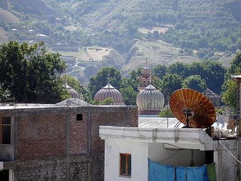
Moving on up the Chitral Valley past Drosh, we come to Chitral, where hippies migrated in the 1960's and 1970's for its legendary hashish. Even back then, it was very difficult to get in, as all entry to foreigners was banned, and you could only get in with an invite from a resident.
When Frontline traveled through the Lowarai Pass between Dir and Drosh, they looked in the guestbook and noted that only two Americans had been there since 9-11, a period of almost a year. The soldier manning the post joked and said that one of the two Americans was a spy.
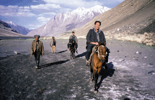
 Stomach-churning switchbacks on the road to Lowarai Pass. This terrible road is one of the best roads in this part of Pakistan. The Phalura people live here. Their language is related to the Kohistanis 40 miles to the west; the Phalura apparently moved to this area from Kohistan several centuries ago for unknown reasons. Bin Laden and Zawahiri were apparently in this area in July and August 2002. Are they there now?
The people here are Sunnis. A linguist in Sweden, Hendrik Lilgendren, is working on a grammar of the language, a much-needed addition to our knowledge of these poorly documented languages of Northern Pakistan.
Chitral is now a trekking capital for intrepid visitors all over the world, but it is still a great place to hide. There are tourists in the summertime, but in the winter, Lowarai Pass, its window to the world, is generally snowed in. Air access to Chitral is meager at best, and the electricity and Internet go out all the time. This year, perhaps ominously, Pakistan closed the entire Chitral region to tourists due to "security reasons".
The local governor has reportedly forbidden intelligence officers from searching the area and local politicians have been protesting, perhaps a bit too much, that bin Laden is nowhere in the area. Fundamentalist Islam is big even in Chitral, where the local Islamist party this summer protested women having their own stalls in the market.
In late August 2006 (less than 3 months ago), Al Qaeda authority Peter Bergen said US intelligence was starting to focus on Chitral as a possible hideout for bin Laden. This conclusion was based on an analysis of the trees in Al Qaeda videotapes and the length of time it seems to take to deliver Al Qaeda tapes after they have been made (about 3 weeks).
Another interview with Bergen for a CNN program called "In the Footsteps of Bin Laden" aired in September 2006 elaborates along the same lines, and says that Chitral is considered "inaccessible" and that US forces are banned from the area at any rate.
Note this recent article from September, though, that notes that since January 2006, a special US bin Laden task force called Task Force 145 is now allowed to go into Pakistan without permission to hunt bin Laden.
 Chitral, where as recently as August, US intelligence felt that Osama bin Laden was hiding. A CIA team rented a home here to search for him until they were chased out this Spring. Some think he is living a quiet, paranoid life here in a home with only a few other people. He would hardly ever go out and his visitors would be very tightly regulated. He may spend his day listening to radio, watching the news and surfing the net, since he is a news junkie.
Pakistani officials protest that Chitralis do not like bin Laden due to ethnic and religious differences, so it is unlikely that he is in the area. A tiny CIA (reports say it was FBI, but CIA here is always referred to as FBI, in order not to inflame Pakistani sensibilities) team rented a home in Chitral in Winter 2005 under the cover of being investors trying to bring business to the area.
By Spring, local politicians found out about them, and were but was raising a fuss about them after their location was revealed by a local politician, but by that time, they were already gone.
There is another report, this one from June 17, 2005, from ABC's Brian Ross. In this case, a group of Arabs came down from Nuristan to a small market town in the Chitral District and loaded up on large quantities of supplies, including wheat and flour. Then they headed back to Afghanistan. I do not know what town in Chitral they came to. It seems probable that this group was connected to the Al Qaeda leadership.
People in Chitral mostly speak Khowar, a Dardic language with 240,000 speakers that is distantly related to Hindu and Persian and more closely to Punjabi, Kashmiri and Sindhi. You can see the tremendous differences between it and Pashto, Hindi, and even Nuristani in this lexical chart. Note the occasional cognate though, such as "eye".
About 15-20 % of speakers are literate in the language. Nevertheless, Khowar, I am happy to say, is being well-developed as a literary language.
Adding weight to the theory that bin Laden may be or may have been in Chitral is a recent report from ABC News that more foreigners have been seen lately in the Waziristan and Bajaur Agencies of FATA, and in the Dir and Chitral Districts of NWFP. In all of these areas (including Chitral), the Taliban have been openly recruiting for jihad in Afghanistan.
The heightened presence of foreigners and open recruiting is apparently due to recent peace deals between the Pakistani government and jihadis in North and South Waziristan that essentially handed over power there to Al Qaeda and the Taliban.
Moving north of Chitral, this article from around the same time, late August of this year, says bin Laden was thought to be hiding north of Chitral, around the towering Tirich Mir Mountain, a soaring peak that rises to 25,289 feet. No source was given but Western intelligence agencies are usually the sources of these tidbits.
 Tirich Mir Mountain, where in August, US intelligence sources suspected Osama bin Laden may be hiding.
 A nice webpage on this mountain, with some spectacular pictures, is here.
 The Chitral River near Tirich Mir, north of Chitral. This river cuts a wide swath through the canyons here. Good luck getting across it.
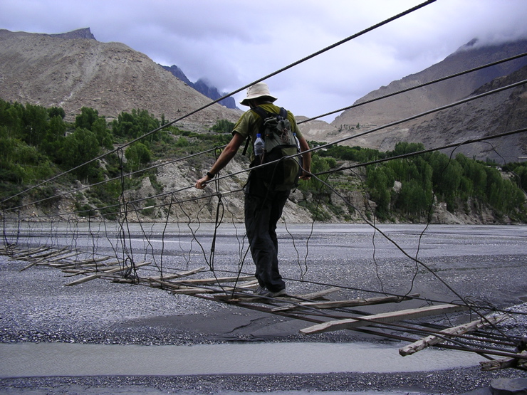 You were wondering how you get across the Chitral River in this area? Like this. As you can see, motor vehicles cannot cross here and typically pack animals cannot either.
There are plenty of caves around there too, sympathetic tribesmen, a ban on US forces operating in the area, and few to no roads. Another great place to hide.
 Goats on the road near Tirich Mir, north of Chitral. Is that a paved road? Amazing.
On a map, Tirich Mir can be seen in the far northwest corner of Pakistan, north of Chitral and south and west of the border with Afghanistan.
 Kuragh Ridge, near Tirich Mir north of Chitral. A very recent intelligence report in August placed Osama bin Laden here.
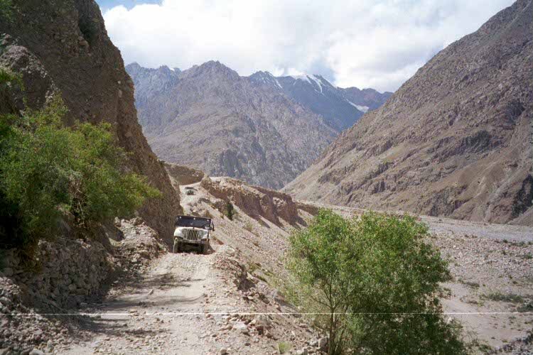 A road in the Yarkuhn Valley, about 1/2 way between Tirich Mir and Darkot. This is the best road in the area!
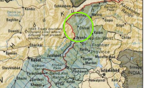 The area circled shows the location of various areas discussed in this post, including Chitral, Tirich Mir, Drosh, Dir, Salim Shah, Dorah Pass, Garam Chasma, the Kuragh Ridge and the Kumrat Valley.
 Kohistan, where the Al Qaeda leadership was thought to have moved to from Chitral this summer. The trees and terrain here do resemble that seen on a videotape of bin Laden and Zawahiri in 2003, I must admit. This photo also looks very much like Nuristan Province in Afghanistan, where the leadership has also long been rumored to be hiding. It also reminds me of Idaho in the US Northwest.
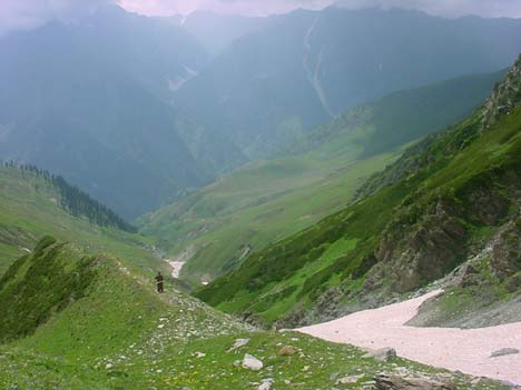 Stunning Kohistan. This photo looks like the Caucasus Mountains on Russia's southern border. What a great place to hide! Why not hang a Welcome Al Qaeda sign?
A nice web page on Kohistan is here. Kohistan (population 2 million) is one of the most isolated and deprived areas in Pakistan, and the illiteracy rate ranges from 94-98%!
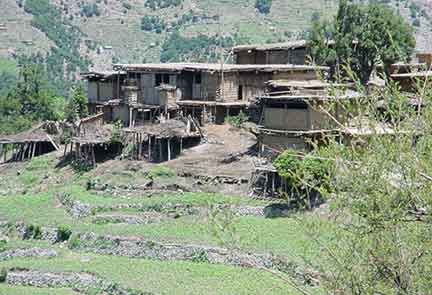 A dwelling, or series of dwellings, on a terraced field in Kohistan. Crops do not grow well in this region at all, with poor weather and rocky soils being major factors.
 Harsh winters in stunning Kohistan add to the isolation of this region.
This link has an excellent description of the people and language of this region (pdf). Since the creation of an alphabet in 1995, Kalami is now a written language with an Indo-Arabic script similar to Urdu. Three books have now been published in Kalami by the Kalam Cultural Society. Links to two of those books are here and here. Some stunning photos of the Kalam area can be seen here.
The Kalamis are similar in many ways to the Kohistanis of Afghanistan, who were described in detail in a previous post of mine. They are all strict Hanafite Sunni Muslims.
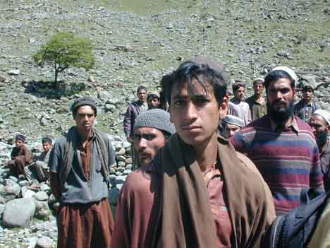 As you can see, the natives here in Kohistan are not particularly friendly. "Who are you looking for? Osama who? Never seen him." Afghan Nuristanis often have similar hostile expressions towards visitors.
As with the Kohistanis in Afghanistan, almost all men are armed at all times in order to defend themselves against their numerous enemies, since most of them are engaged in continuous feuds with other Kalamis, usually revolving around women and honor.
A Pakistani official recently stated that Kohistan is the most lawless area of all Pakistan, and Dir Kohistan was the most lawless part of Kohistan. Feuds kill about one person every two weeks in the Tal Region.
 The strict Sunni Muslims here in are all armed, all the time, and ready to fight. That and they don't like strangers, especially nosy infidels. For bin Laden, Kohistan is paradise.
Kohistani women are treated terribly in Kohistan, as they are in Afghanistan. Kohistani women are treated even worse than Pashtun women, which is pretty bad!
This region is extremely inaccessible. There are only two roads in the entirety of Pakistani Kohistan, and those are pretty bad.
 A typical "road" in Kohistan. Inaccessible by any motor vehicles; you need to access places like this either on foot or by donkey. Nuristan in Afghanistan has similar terrain and a similar "road" system. The first road in Nuristan was reportedly built in 1979.
Most travel here is on foot or by mule on narrow rocky trails.
Bridges are often narrow hanging bridges over raging, torrential rivers tearing through soaring canyons. The bridges are so narrow and rickety that often pack animals will refuse to cross them, rendering much of the area inaccessible even by mule!
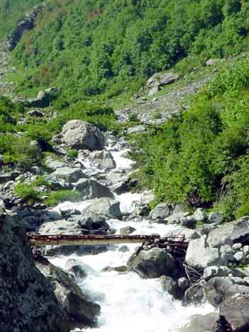 That is called a bridge in Kohistan - a log over a raging torrent of a river plunging down a skyscraper canyon. If you hide here, no motorized vehicle can get to you. Search teams must come by mule or on foot and you will be warned far in advance.
 That's barely even a trail. This is what passes for a road here in Kohistan. An enemy army here is confined to mules or boots. This is the terrain US forces have to deal with in Kunar and Nuristan in Afghanistan. Have fun!
As you can see, this is an excellent place to hide! US forces are not allowed here and Pakistani forces cannot access most of the region via motorized vehicles.
 A typical hanging bridge in Kohistan. Nuristan in Afghanistan has many similar bridges that often look remarkably like this one.
 Often, pack animals simply refuse to cross these Kohistan foot bridges over raging alpine rivers. Surely, anything with four wheels is useless here. The bridges and scenery in Afghanistan's Nuristan are quite similar.
 Lush forests and soaring peaks in this photo of Kohistan look like the Sierra Nevada near my home. The forests here are still intact, unlike those in much of the region.
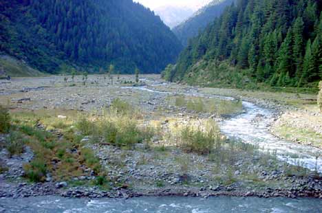 Spectacular scenery in Kohistan as a smaller tributary meets a larger river amidst soaring, impenetrable forests. This could be Alaska, Western Canada (British Colombia) or Norway.
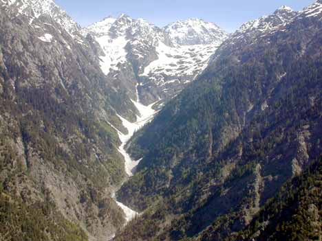 Kohistan is a paradise for wildlife, even rare predatory mammals that are barely holding their own elsewhere. Can you imagine Al Qaeda's most wanted hiding here? This photo looks like the Rocky Mountains in Canada.
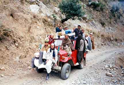 There are a few roads in Kohistan, if you can call that a road! This is transportation at its finest in this region.
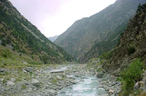 Floods raged through these canyons in Kohistan 14 years ago, devastating an already deprived area and isolating it even further.
 Rain in Kohistan, with snow on the ground. The climate here is extremely wet, with lots of snow in winters and plenty of rain the rest of the year.
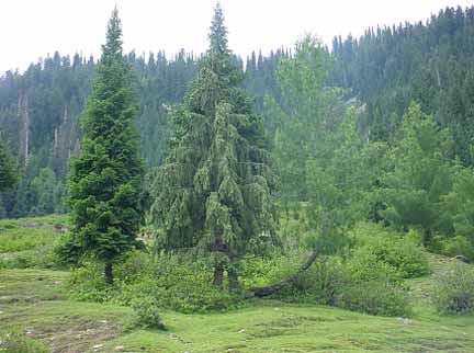 The gorgeous forests of Kohistan. By examining the trees in an Al Qaeda video from 2003, the CIA thinks it is pinning down where bin Laden is located. This photo could be of the Black Forest in Germany, the US' Washington state and Canada's province of British Colombia in the Pacific Northwest, Chile's Patagonia, or Russia's endless Siberian forests.
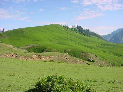 Residents in Kohistan graze animals on the gorgeous alpine meadows here. This looks like the Alps.
Moving even further to the north and off the map above, in this fascinating Christian Science Monitor article by Scott Baldouf on August 9, 2002, Al Qaeda Massing For New Fight, Ayman Zawahiri was said to be holding sway at a new base constructed by Al Qaeda in the town of Shah Silim (map).
 A village near Garam Chasma, which is close to Shah Salim, where Al Qaeda reportedly had a large base in 2002. Look at those craggy, forbidding peaks.
 The road along the Lutko River from Chitral to the Dorah Pass is actually accessible by jeep. This is near Shah Salim.
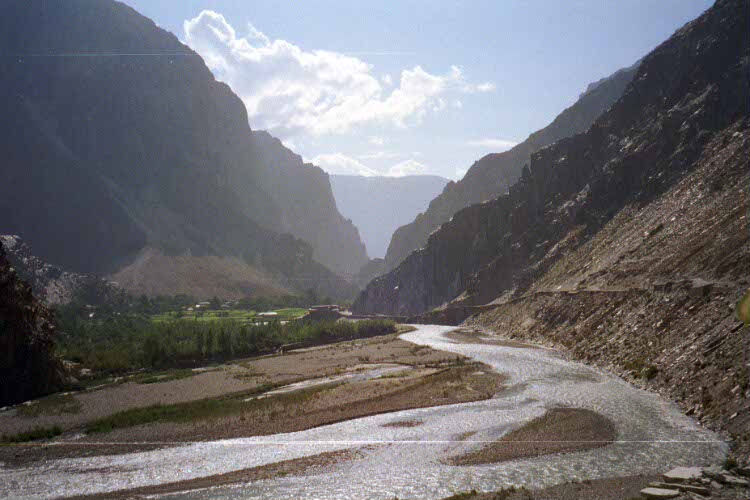 Spectacular footage and forbidding terrain near Garam Chasma, close to the Shah Salim Al Qaeda base. The people here are speak a language called Yidga.
 The Afghan side of Dorah Pass, the famous route used by the mujahedin in the Soviet War. The people in this area used to be mostly Munjis, but most of the Munjis left to Pakistan with the war. It's not known if they have returned or not yet.
Across the border in Afghanistan, people speak another Pamir language called Munji that is somewhat closely related to Yidga (about as close as English and Dutch). Most Munjis fled Afghanistan and settled in Pakistan during the Soviet War.
A fascinating Australian Medical Journal article in 2002 reported on the experience of a doctor, Robert Simpson, working with MSF (Doctors Without Borders) in the region in 1999, albeit 60 miles north of Salim Shah in the Badakhshan town of Baharak (map here). This article gives you an idea of what things are probably like in Salim Shah.
The living conditions in this region are simply appalling. This is a region where there are no roads, no communications, no water, no power, and basically, no government, along with a population engaged in constant warring and feuding.
 On Dr. Simpson's trip to the Wakhan Corridor, his Afghan guides decided to go fishing - with explosives!
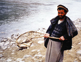 Results of fishing with explosives in the Wakhan Corridor.
A variety of terrible diseases regularly ravage large sectors of the population, and cures or even treatments are typically nonexistent. Three people were stoned to death while he was there. For Afghanistan as a whole, infant and maternal mortality figures are amongst the worst on Earth (Afghanistan's maternal mortality rate is exceeded only by Sierra Leone) and life expectancy is a mere 45 years.
In Baharak, all of those figures are worse, if you can imagine that. The linked article includes disgusting photos of Afghans afflicted with the bizarre and terrible illnesses that ravage this region.
Moving further along the Wakhan Corridor, an area even poorer and more devastated than the rest of Badakhshan, if you can believe that, we note that on August 17, 2006 (4 months ago) bin Laden and Zawahiri were reportedly in the Pakistani town of Darkot, on the border between Pakistan and the Wakhan Corridor of Afghanistan.
 Another precarious bridge, this time near Darkot and the Wakhan Corridor. People are using yaks to cross this bridge.
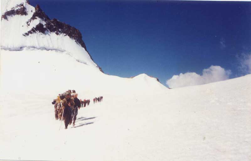 Crossing Darkot Pass on the border of Pakistan and Afghanistan. Remind you of Tora Bora and Al Qaeda's escape through similar snowfields and peaks? Yes, it does.
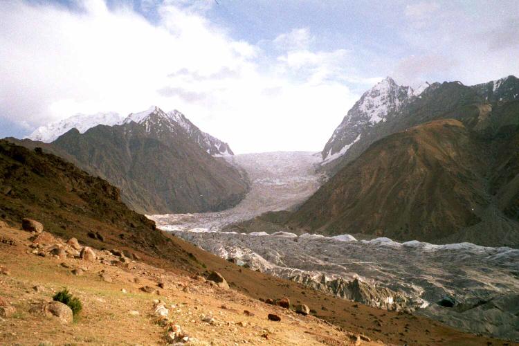 Darkot Pass, another view, where the Al Qaeda leadership was reportedly hiding out this August.
 Trekkers riding yaks near Darkot. The preferred way to travel here is by yak! The Al Qaeda leadership was said to be here this summer.
A very large percentage of the population is using opium here, possibly because it is about the only "medicine" available.
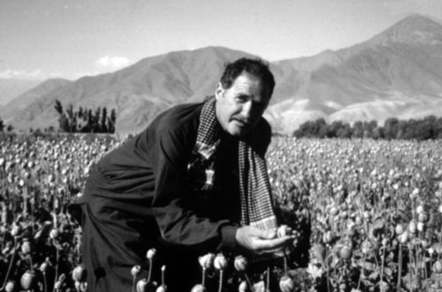 Dr. Simpson in an opium field in Badakhshan.
On Simpson's visit, he reported that in one village, the last foreigner had passed through 20 years ago. In another, an entire village of 300 had been devastated by a klebsiella bacterial infection, probably spread by poor sanitation. At one point, there were hardly any villagers strong enough to even fetch water for the rest. The outbreak could easily have killed the whole village.
 Dr. Simpson traveling along the Wakhan Corridor. The health and general living conditions here are truly horrible. This photo looks like the Andes.
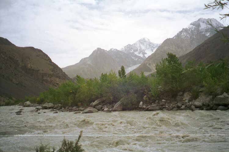 A raging, muddy, torrential, flooding river near Darkot. The wild, nearly unknown lands near Chillinji look similar. This entire area was evacuated this summer after reports that bin Laden and Zawahiri were hiding somewhere here. I would expect to see an Abominable Snowman in a place like this. This photo actually looks like Patagonia in Chile.
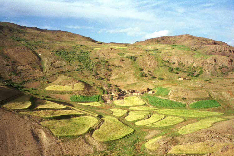 A village near Darkot, one of the highest villages in the area. The terrain around Chillinji is very similar. The first modern expedition to Chillinji only explored this area in the 1990's.
This 17,549 ft. pass is the 5th highest pass in the Hindu Kush. A report places the Al Qaeda leadership in Chillinji about 1 month before they were seen in Darkot.
 The Darkot Glacier, viewed from the West. Take your breath away.
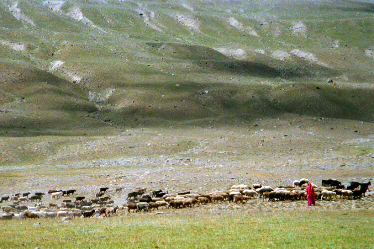 Herding yaks near Darkot in terrain reminiscent of Tibet. Was the Al Qaeda leadership here this summer?
The area has two advantages for Al Qaeda - US forces are not permitted there, and the proximity to China means that bombing by US air power is probably not an option due to the fact that a diplomatic row may ensue over US planes bombing targets so close to Chinese territory.
 A precarious bridge over a raging, muddy torrent bashing away at an apparent glacier near Darkot. Tell me how a modern army travels through this terrain?
There were 100's of tourists in the area at the time, mostly trekkers, and all were reportedly evacuated. The report was confirmed by Western intelligence in Islamabad.
The linked report above goes on to speculate about a Chinese connection to Al Qaeda, either governmental, or (more likely) via East Turkestan separatists, who are long known to be allied with Al Qaeda through attending courses at Al Qaeda's training camps under the Taliban's rule.
We seem to have come full circle here. Soon after the US invasion of Afghanistan, US Special Forces were hunting bin Laden in the very same Wakhan Corridor. At the time, the theory was that the top AQ leadership was hiding in caves in the corridor in a cave complex that was supposedly built by the Russians.
This complex very high in the mountains was supposedly so high-tech that it was heated. Special Forces were using thermal sensors in the winter to look for a possible heated shelter in this area. Nothing ever turned up, and no one has ever conclusively shown that this supposed base even exists.
 Close to Darkot. The peaks in the background look like the Himalayas. You see Osama anywhere around here? Neither do I.
Those interested in some truly spectacular photos of the Chillinji/Darkot Pass area are urged to check out the site of photographer Steve Razzetti. Once inside, click on the slide show marked Hindu Kush. Most of the photos are of the area around Chillinji and Darkot. The Chilinji area looks quite a bit like the Darkot photos in this post.
 Near Darkot, the soaring peaks bring to mind the Matterhorn in the Alps or Everest in the Himalayas.
 A breathtaking photo of the area near Murkushi, with a typical barely passable bridge and cascading gorge. This area is impassible by motor vehicles and often even pack animals because they are afraid of these bridges. Hence, the only access is by foot.
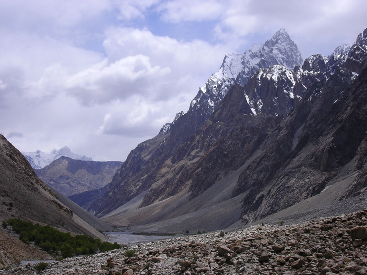 The incredible view of Kilik Pass. Kilik Pass is only about 5 miles north of the supposed Al Qaeda training camp at Murkushi.
 Mintaka Pass, about 5 miles east of Murkushi, the site of a reported Al Qaeda training camp. Photo is from the Pakistani side. The pass is about 15,500 feet.
 The stunning view, looking from Kilik Pass southeast to Mintaka Pass on the Chinese-Pakistani border. This area is so close to China that it is de facto controlled by the Chinese. Furthermore, the proximity to China means that US jets cannot bomb here for fear of setting off a world crisis with the Chinese.
 A great and hard to find photo of the area right around Murkushi. Al Qaeda supposedly had a large base here in Summer 2002.
Afghan intelligence concluded that the Murkushi base may be being controlled by the Chinese government, a theory the Machiavellian implications of which are presently boggling my mind. I will leave it to the reader to toss that idea around!
The people residing in Darkot, Chillinji and Murkushi are generally Wakhis, an Ismaili Shia Tajik people numbering 50,000 worldwide.
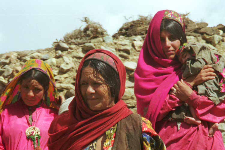 Wakhi women and girls near Darkot. Note the colorful dresses of these Ismaili Shia women. Women here are not under the restrictions of purdah one finds as one goes west towards Chitral.
Wakhi is related to Iranian and Tajik, but fairly distantly. It is even rather diverse within its Pamir subgroup, as this lexicon shows. Wakhi is now a written language, and 60% of Pakistani speakers can read and write it. There is also a radio program in Wakhi in Pakistan. Most male Wakhis in Pakistan can also speak Urdu.
In other places, especially Afghanistan and Tajikistan (especially), Wakhi appears to be losing ground in favor of Pashto or Tajik. In Pakistan, Wakhis refer to themselves as Tajiks. Tajik nationalists claim that Wakhi is a dialect of Tajik, but a quick look at the lexicon above shows how ludicrous that claim is.
There are also some speakers of Burushaski, an obscure language isolate (not related to any known languages) here, especially in the Hunza around Murkushi. I have studied Burushaski extensively (in particular, the work of John Bengston) and I now feel it is related to Sino-Tibetan, Basque, Ket and the North Caucasian languages like Chechen in a super-family called Dene-Caucasian), although that is a highly controversial theory.
The Bengston book I read back in the 1990's mostly dealt with Yenisien (the Ket family), some Caucasian languages and Basque, and I felt it was quite convincing.
Khowar and Shina are also spoken in the Yasin and Ishkoman Valleys near Darkot and Chillinji.
 River crossing near Darkot. This party had a jeep but they had to abandon it miles back because it was no longer possible to travel by jeep. They switched to donkeys, which they are using to ford this wide, wild river. A mechanized army is useless here; an excellent place to hide.
An interesting fact is that in Chillinji, Darkot and Murkushi, the purdah system, whereby women are kept out of sight in public, pretty much vanishes, and girls and women walk freely about and anyone can look at them, whereas in most of Chitral, even in the Ismaili areas, the purdah system prevails.
 Wakhi girls near Darkot. Not only do they walk around freely, but you can actually look at them and even take their photos! Gasp! Note the bright outfits and the neat jewelry hanging from them. The girl on the right has very noticeable Asian features.
It also has a nice list of the 70 languages spoken there, with number of speakers, locations, and in some cases, notes about language shift (a process of language death whereby speakers quit speaking their native language in favor of another, usually more widely spoken language).


